


Alpina Antica Trail
From Lake Chiemsee across the Alps to Venice
The Alpina Antica Trail is a cross-border long-distance hiking trail with 38 day stages that connects historic mule trails and ancient pilgrim routes from Lake Chiemsee through Kirchberg, Mittersill, Heiligenblut, Kötschach-Mauthen, and Venzone to Venice.
On stages 8 through 15, the Alpina Antica Trail passes through the Hohe Tauern National Park holiday region and continues on to Heiligenblut in Carinthia. The trail descends from the scenic ridge of the Wildkogel to the herb-growing village of Hollersbach. It then winds from town to town along the Salzach Valley to Kaprun.
From there, the trail leads uphill again: over the Brucker Berg to the Ponyhofalm in the Fuschertal valley. Stage 14 takes hikers deep into the Hohe Tauern National Park to the Trauneralm at the foot of the Großen Wiesbachhorn. On Stage 15, long-distance hikers cross the main Alpine ridge via the historic Hochtor trade pass and reach Heiligenblut am Großglockner.
In the Steps of the Muleteers
Following in the steps of muleteers and peddlers, the Alpina Antica Trail winds through some of the most impressive landscapes in the Alps. This cross-border long-distance hiking trail combines nature, history, and culture, following ancient paths that have connected the north and south for hundreds of years. In the heart of the Hohe Tauern National Park, this history comes to life in a particularly striking way: majestic peaks, pristine valleys, and centuries-old mountain passes accompany hikers on their journey south.
Long-Distance Hiking in the presence of the Großglockner
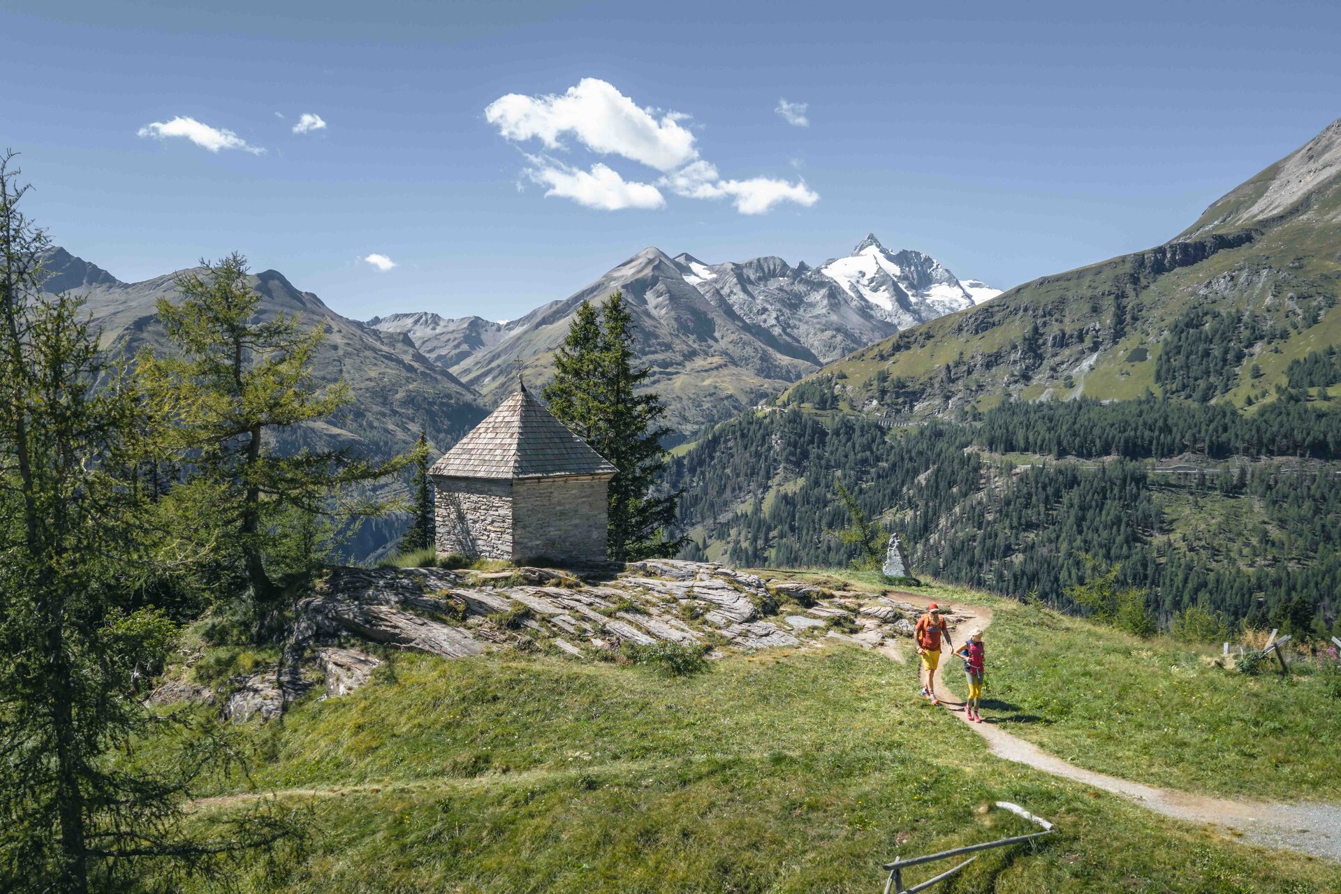
Long-Distance Hiking in the presence of the Großglockner
A special highlight of the Alpina Antica Trail is the impressive high-mountain landscape of the Hohe Tauern. Austria’s highest peaks, led by the Großglockner, provide the spectacular scenery for several stages.
Here, the experience of a modern long-distance hike blends with the stories of those who crossed the Alps on foot long before us.
Well prepared for the Alpina Antica Trail
Which stage suits your fitness level? When are the higher-altitude sections accessible, and where can you stay overnight? This information will help you plan stages 8 through 15.
Difficulty at a glance
| Stage | Route | Duration (according to the tour portal) | Technical difficulty |
|---|---|---|---|
| 8 | Aschau – Wildkogelbahn | approx. 6 hrs. 20 min. | T3 |
| 9 | Wildkogelbahn – Hollersbach | approx. 4 hrs. 40 min. | T2 |
| 10 | Hollersbach – Mittersill | approx. 4 hrs. 15 min. | T2 |
| 11 | Mittersill – Niedernsill | approx. 4 hrs. 20 min. | T2 |
| 12 | Niedernsill – Kaprun | approx. 5 hrs. 50 min. | T2 |
| 13 | Kaprun – Fusch an der Großglocknerstraße | approx. 5 hrs. 50 min. | T2 |
| 14 | Fusch an der Großglocknerstraße – Trauneralm | approx. 4 hrs. 35 min. | T2 |
| 15 | Trauneralm – Heiligenblut | approx. 7 hrs. 50 min.* |
T3 |
T2 refers to mountain hiking, and T3 to challenging mountain hiking according to the Swiss hiking scale. Outdooractive rates the overall difficulty of all the stages listed here as “difficult.” This overall rating also takes into account the physical demands and should not be equated with the color-coded trail markings.
The time information is provided as a guide. Take your personal pace into account and allow sufficient time for breaks and to build in a margin.
*Stage 15 includes a shuttle transfer. Coordinate walking times, pickup, and transfer duration with the provider in advance.
See detailed stage descriptions and maps
Alpina Antica Trail | ET8 Aschau - Wildkogelbahn
A challenging stage along the old mule trail up to the scenic ridge of the Wildkogel, high above the Pinzgau.
- 17 km
- Ascent: 1,261 hm
- Descent: 173 hm
- View the route for Stage 8 >>
Alpina Antica Trail | ET10: Hollersbach - Mittersill
From Hollersbach through Wasenmoos to the town of Mittersill, one of the most important centers of mountain trade.
- 13.8 km
- Ascent: 495 hm
- Descent: 514 hm
- To the route for Stage 10 >>
Alpina Antica Trail | ET12: Niedernsill - Kaprun
Through villages and alpine pastures above the Salzach Valley all the way to Kaprun.
- 16 km
- Ascent: 1,025 hm
- Descent: 1,024 hm
- To the route for Stage 12 >>
Alpina Antica Trail | ET14: Fusch an der Großglocknerstraße - Trauneralm
In the Hohe Tauern National Park at the foot of the 3,564-meter-high Großes Wiesbachhorn.
- 14.4 km
- Ascent: 800 hm
- Descent: 87 hm
- To the route for Stage 14 >>
Alpina Antica Trail | ET9 Wildkogelbahn - Hollersbach
Over the gentle ridges of the Kitzbühel Alps to Hollersbach, the village of herbs and art.
- 15.1 km
- Ascent: 256 hm
- Descent: 1,536 hm
- To the route for Stage 9 >>
Alpina Antica Trail | ET11: Mittersill - Niedernsill
From town to town along the Salzach Valley.
- 16.9 km
- Ascent: 142 hm
- Descent: 176 hm
- To the route for Stage 11 >>
Alpina Antica Trail | ET13: Kaprun - Fusch an der Großglocknerstraße
High above the Salzach and Fuschertal valleys to the foot of the main Alpine ridge.
- 17.8 km
- Ascent: 940 hm
- Descent: 897 hm
- To the route for Stage 13 >>
Alpina Antica Trail | ET15: Trauneralm - Heiligenblut
Crossing the main Alpine ridge along an old trade route over the Hochtor to Heiligenblut am Großglockner.
- 22.8 km
- Ascent: 1,221 hm
- Descent: 1,454 hm
- To the route for Stage 15 >>
What qualifications should you have?
For the mountain stages, you’ll need to be in good physical condition, sure-footed, and experienced in mountain hiking. On narrow, steep, or exposed sections, a head for heights is also required. Choose your stages so that you can handle the demands even over several consecutive days.
Your equipment should include sturdy hiking boots, weather-appropriate clothing, protection from rain, cold, and sun, plenty of water and food, as well as a cell phone and a first-aid kit. Save maps and route descriptions in advance so you can use them without an internet connection.

When is the best time to hike?
As a general guideline for the alpine stages, the best time is from mid-June to the end of September. However, the current snow conditions, weather and trail conditions, as well as the opening hours of the lodging facilities, are decisive factors. The period mentioned is no guarantee that all sections will be passable.
In particular, snowfields may still be present at the Hochtor at the start of the season. Therefore, be sure to check the conditions on the higher-altitude sections before your hike.

Overnight stays and timely reservations
Depending on the stages, hotels, guesthouses, and mountain huts are available along the trail. Make your reservations well in advance and plan your daily stages based on the availability and location of your accommodations. Also check opening hours, dining options, and any necessary transfers.
The official Trail Information and Booking Center can assist you with selecting and booking accommodations. Local tourism offices can also help with any questions you may have about accommodations.
Check Current Trail Conditions and Closures
Before each stage, check the current tour description and the information available there under “Current Info.” If conditions are unclear, also check with the relevant tourism office or your lodging provider regarding trail closures, snow conditions, and possible detours. Pay attention to closures and signage on-site.
- Select a stage and check current tour information
- Check the weather forecast at GeoSphere Austria
- Contact the Trail Info and Booking Center

Hiking in the Hohe Tauern National Park
Whether it’s a leisurely hike in the valley, a family hike, a trail through alpine pastures and to mountain huts, or a challenging mountain tour: In the Hohe Tauern National Park holiday region, you’ll find hikes for all fitness levels and interests.